
In 1978, Anne Dewitt Watts examined the PARC and ARC definitions of the region to assess the extent to which “the two major sets of variables used to define the region—socio-economic characteristics and physical characteristics—correlate with each other” (Watts 19).
The Watts “mountain terrain” map shows the relationship between the 1964 President’s Appalachian Regional Commission (PARC) recommended boundary of the region and the areas classified as hills, high hills, low mountains, open high hills, and open low mountains. She found a “high degree of correlation” between the region as defined by PARC and rough terrain, though an additional 14 counties in Ohio and 19 counties in Virginia also have rough terrain but were not included (24).
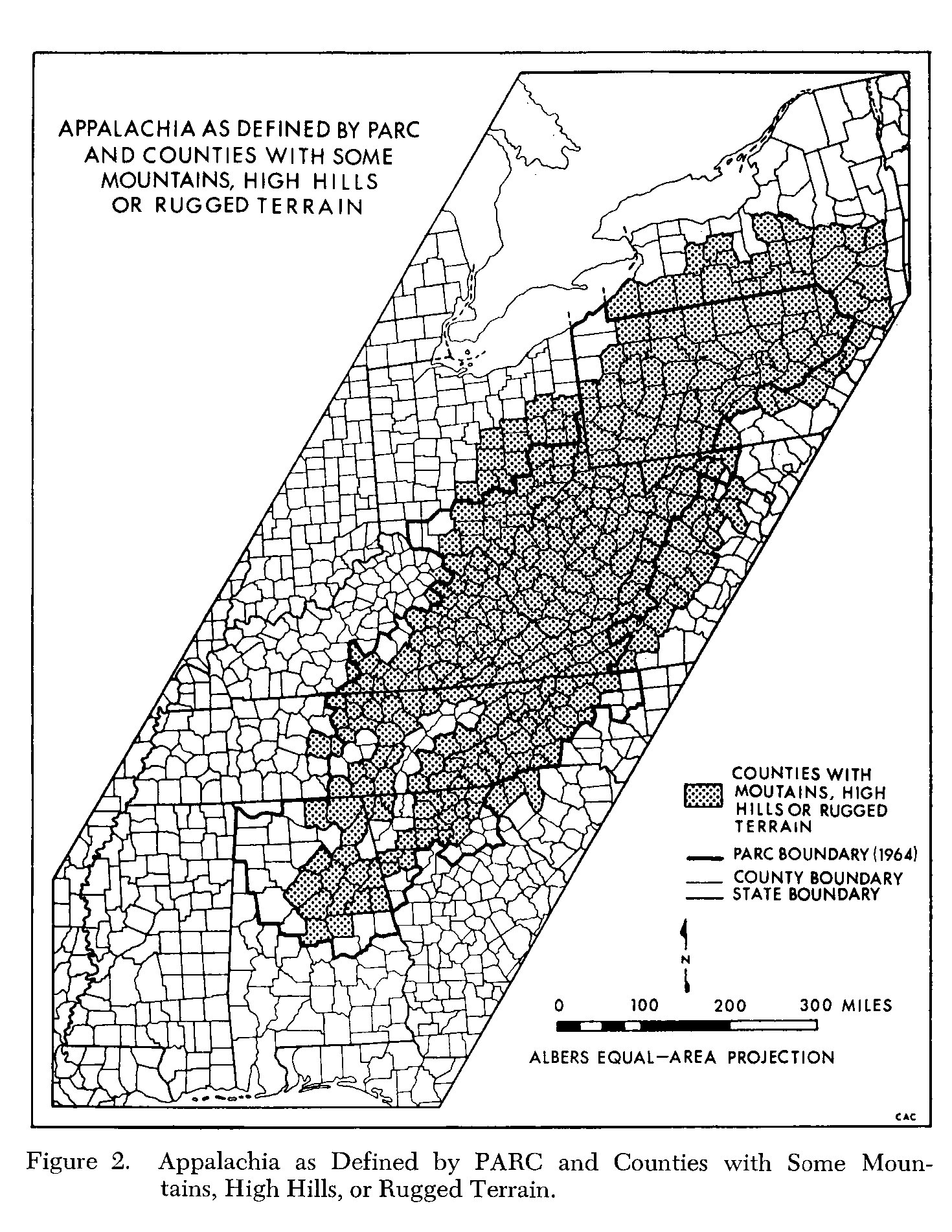
From Ann DeWitt Watts, “Does the Appalachian Regional Commission Really Represent a Region?,” Southeastern Geographer 18 (1978): 19- 36.
List of Counties | View Dynamic Map Individually | ArcGIS Shapefile | Compare and Contrast Maps