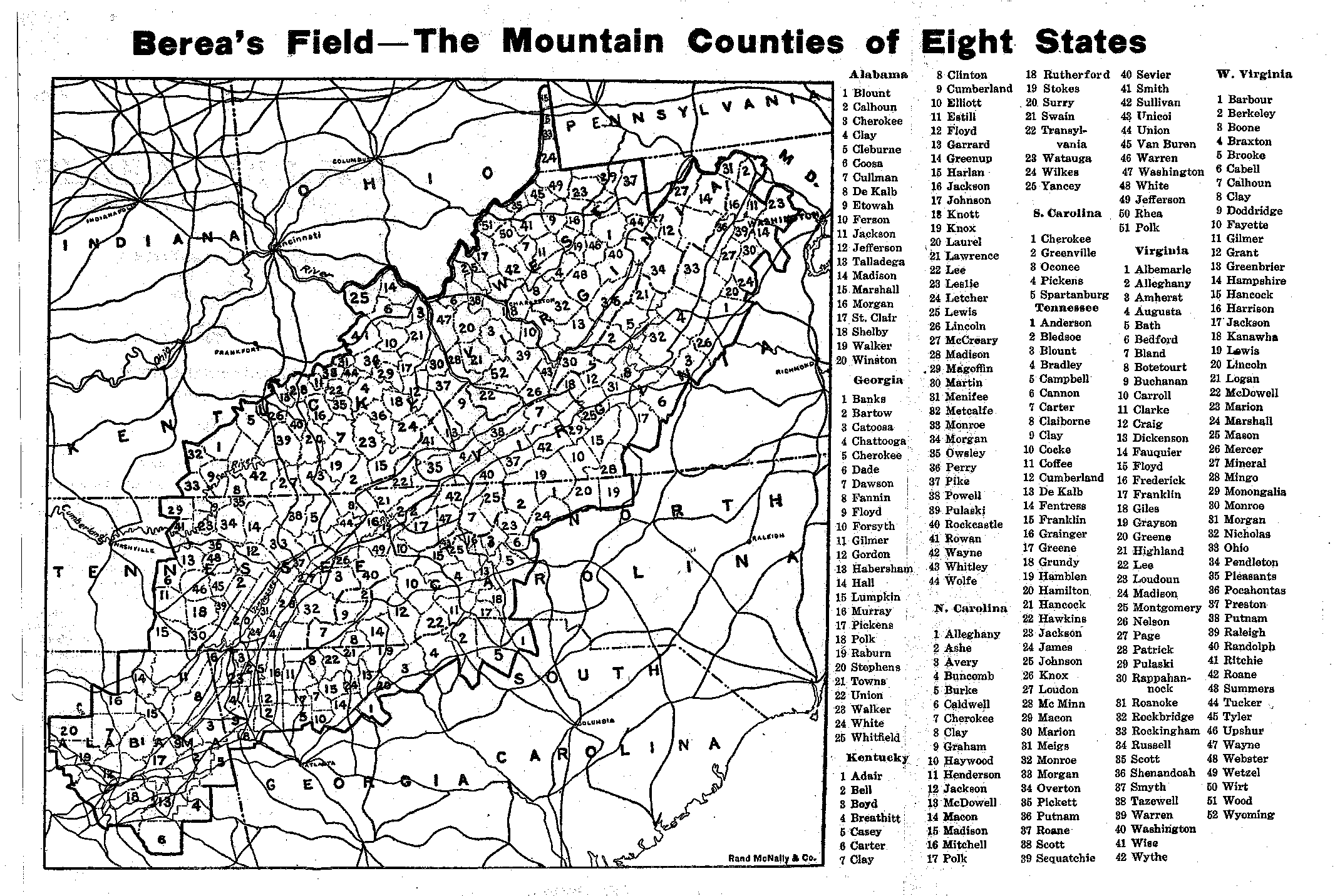
In 1916, Berea began to restrict admission to students from the mountain region as defined by the Russell Sage Foundation. “In 1917, there appeared for the first time in the catalog a list of the mountain counties,” totaling 265 (Ambrose 2). Our ArcGIS recreation is based on the map from the 1918 catalog.

Ambrose, Luther M. 1940. “Berea traditions: People served.” Presented to the General Faculty, October 11. Hutchins Library, Special Archives and Collections, Berea College.
List of Counties| View Dynamic Map Individually | ArcGIS Shapefile | Compare and Contrast Maps
