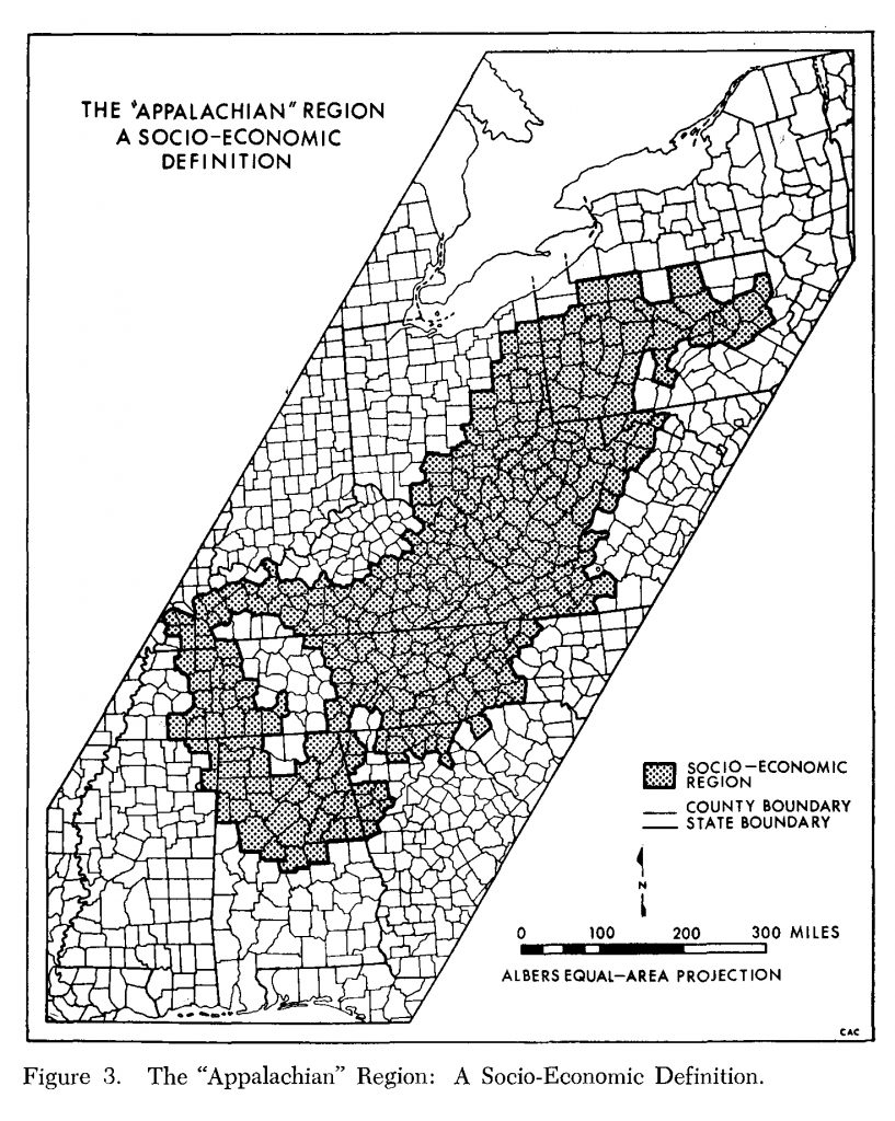
In 1978, Anne Dewitt Watts examined the PARC and ARC definitions of the region to assess the extent to which “the two major sets of variables used to define the region—socio-economic characteristics and physical characteristics—correlate with each other” (Watts 19).
The Watts “socioeconomic region” map compares the PARC boundary with features highlighted in the PARC report and during House and Senate hearings: low income, high unemployment, job deficiencies, lack of urbanization, deficits in education, deficits in living standards, population changes, and unique economic resources (24-25).

From Ann DeWitt Watts, “Does the Appalachian Regional Commission Really Represent a Region?,” Southeastern Geographer 18 (1978): 19- 36.
List of Counties | View Dynamic Map Individually | ArcGIS Shapefile | Compare and Contrast Maps
