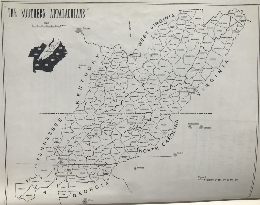
In 1957, W.D. Weatherford, member of Board of Trustees of Berea College, petitioned the Ford Foundation to update the 1935 USDA study. The newer survey, funded by grants from the Ford Foundation and coordinated by Thomas R. Ford, was published in 1962 as The Southern Appalachian Region: A Survey. It included only those “state economic areas” composed entirely of Appalachian counties with “low socioeconomic indicators” according to the 1950 census (Walls; Ulack and Raitz, 41). The Ford region is the smallest region of the six “classic” definitions according to John Alexander Williams.

Raitz, Karl and Richard Ulack. 1981. Appalachia: A comparison of the cognitive and Appalachian regional commission regions. Southeastern Geographer 21 (1): 40-53.
Williams, John Alexander. 1996. Counting yesterday’s people: Using aggregate data to address the problem of Appalachia’s boundaries. Journal of Appalachian Studies 2 (1): 3-27.
List of Counties | View Dynamic Map Individually | ArcGIS Shapefile | Compare and Contrast Maps
