
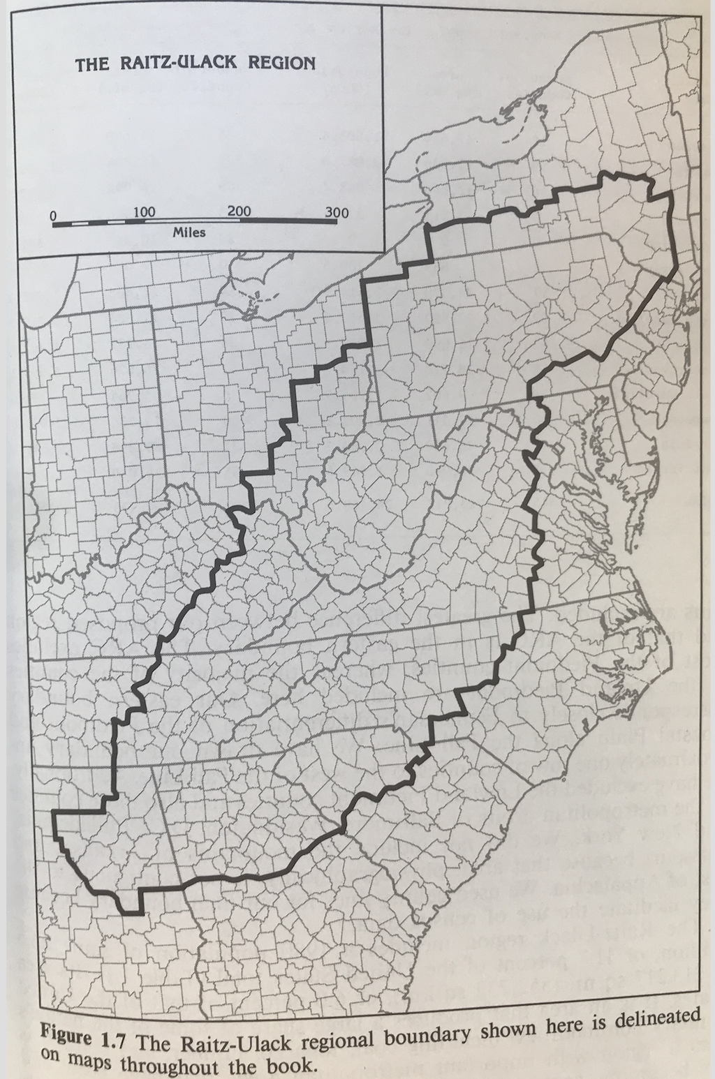
Karl Raitz and Richard Ulack are perhaps best known for their construction of cognitive maps of Appalachia (1981) but they also constructed a definition of the region based on physiography, political boundaries, and cultural and socioeconomic indicators. They noted the omission of the Shenandoah Valley from the ARC region, but included it in their definition due to its significant impact on Appalachian settlement and cultures. At 445 counties, this is the largest Appalachian regional definition that is not solely based on physiography and is the only Appalachian region defined to include parts of New Jersey. Raitz and Ulack’s boundaries follow Fenneman’s physiographic region in the south and west, leading them to exclude many ARC counties. The Raitz-Ulack region ends its northern border with the Hudson and Mohawk rivers in New York state, and its eastern boundary includes most of the Piedmont physiographic province. Metropolitan locations in the northeast are excluded from the Raitz-Ulack definition, as are the mountains of Arkansas.
For more on Raitz and Ulack’s maps of Appalachia, see:
Karl Raitz and Richard Ulack, Appalachia, a Regional Geography: Land, People, and Development (Westview Press, 1984).
Karl Raitz and Richard Ulack, “Cognitive Maps of Appalachia,” Geographical Review 71:2 (1981): 201.
Richard Ulack and Karl Raitz, “Appalachia: A Comparison of the Cognitive and Appalachian Regional Commission Regions,” Southeastern Geographer 21:1 (May 1981): 40-53.
List of Counties | View Dynamic Map Individually | ArcGIS Shapefile | Compare and Contrast Maps